Exploring changes in Brum’s built environment over 100 years
Fantastic post from Birmingham’s Georgian and Regency Streets blog as featured in The birmingham Daily
Jenni Coles-Harris is the author.
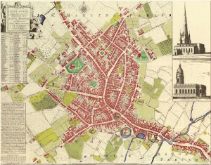
In 1750 a large town was surveyed, and a map drawn up. The map recorded 4,170 houses filled with about 23,688 people. This town was on the edge of Warwickshire; the county town, Warwick, had only about 2,800 inhabitants, and a nearby industrial town called Coventry had 12,117, so this was a sizeable place.
All but one of those houses have been removed from where they stood and that town could not be more different from Birmingham today. This blog explores (as it grows) that absent built environment and how it changed over the next 100 years as well as investigating the driving forces that stimulated that change…
http://mappingbirmingham.blogspot.co.uk/2012/09/architectural-focus-court-of-requests.html


